ENCIBA
CODE: CTM2013-40886-P
Estudio numérico de la circulación 3D de la Bahía de Algeciras y de los procesos físicos y biológicos de su entorno
| CHIEF RESEARCHER | Jesús García Lafuente glafuente@ctima.uma.es |
| FUNDING | 114.950 € |
| FUNDER | Ministerio de Economía y Competitividad |
| DURATION | 01/01/2014 - 31/12/2016 |
| Members | |
OBJECTIVES
The project faces two main objectives:- The first one is the exploitation of the outputs of the 3D numerical models developed in the frame of SAMPA operational system (http://sampa-apba.puertos.es/) to investigate the role played by the Algeciras Bay in the baroclinic water exchange through the Strait of Gibraltar.
- The second objective addresses the primary productivity in the Algeciras Bay by means of Physical-Biological coupled models in order to assess its role in the fertilization of the Alboran Sea. The study is motivated by the fact that the Bay is a large source of antropogenic nutrients that favours primary production, as some satellite images suggest.
RESULTS
THE BAY of ALGECIRAS
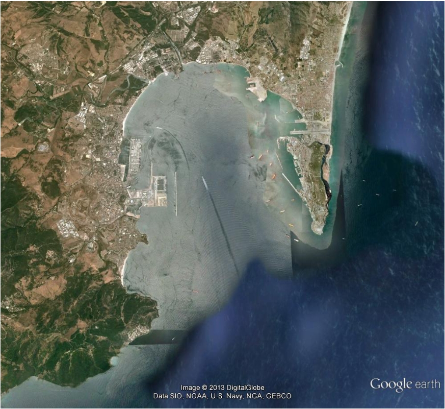
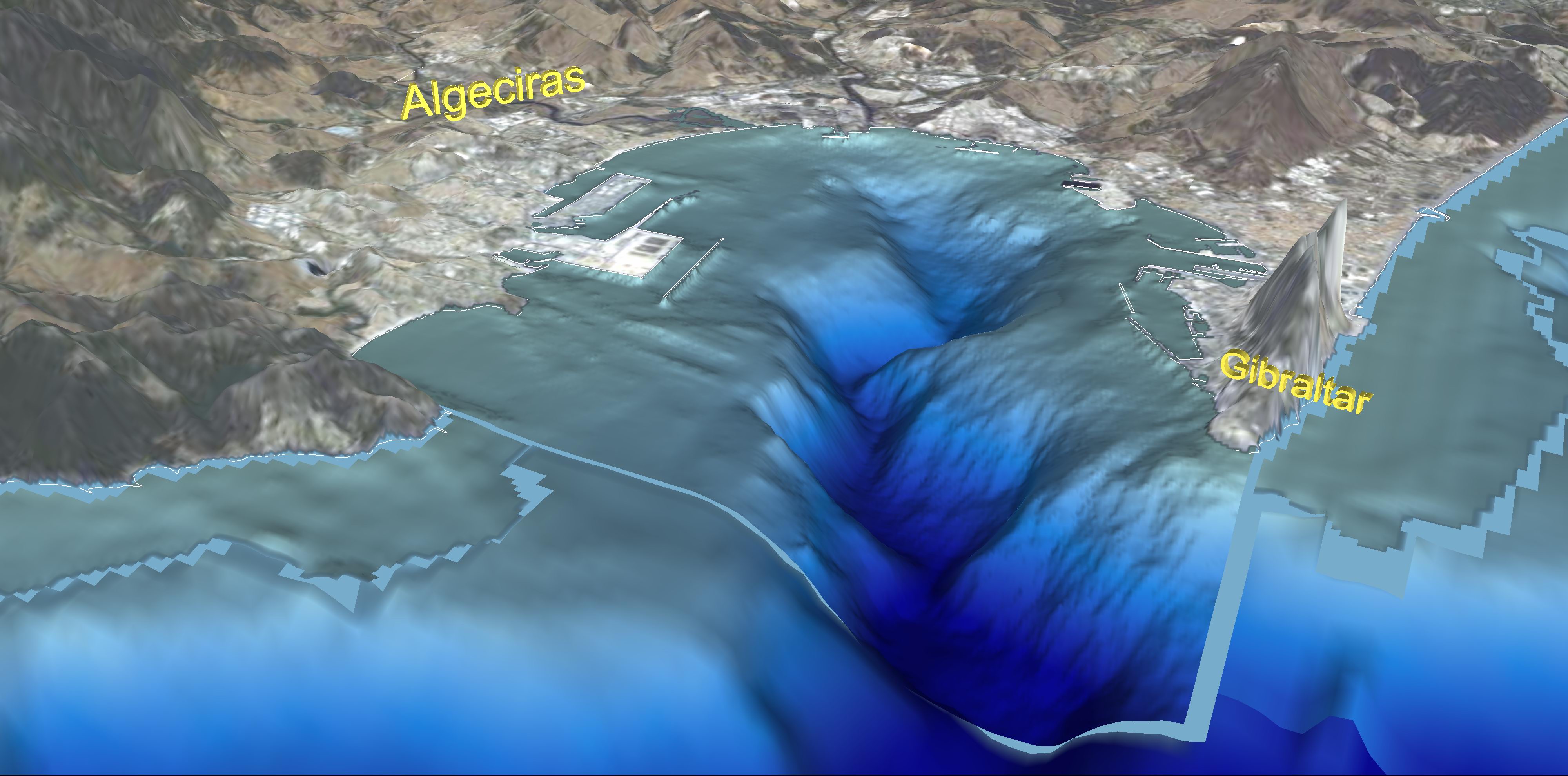
The Algeciras Bay is a natural port whose southern boundary is the line joining P. Carnero at its southwestern end and P Europa at the southeast. Its major axis, running north-south, has a length of 10 km, it is typically 8 km wide, and it has a surface area of 75 km2. The bay is cut by a submarine canyon whose depth reaches 500m at the point where it joins the Strait of Gibraltar, from which the Bay is not separable. Its water volume is around 15 km3, of which 25% exhibits Atlantic water characteristics, the remaining showing up a Mediterranean origin, although there is no solid evidence backing these percentages . In any case, the proportion changes continuosly depending on the tidal and subinertial forcings.

Plane view of the Bay (Google) under its present configuration. Left panel shows the bathymetry.
TIDAL DYNAMICS IN THE ALGECIRAS BAY
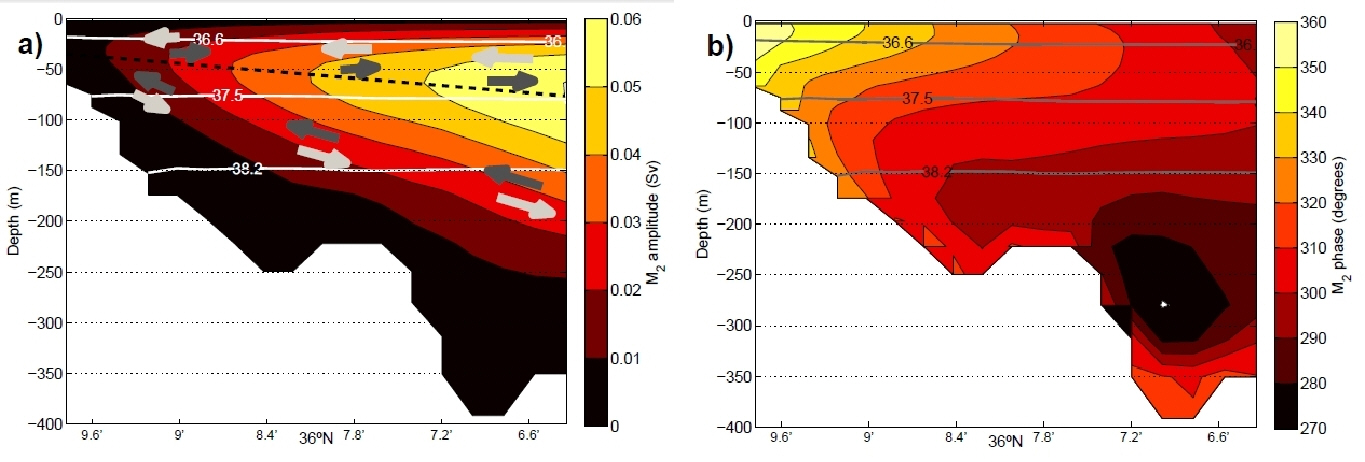
Tidal dynamics prevails over the remaining forcings and shows a clear baroclinic pattern. The tidal exchange forces the upper Atlantic layer in during the flood (rising) tide and the Mediterranean layer out. The direction of the flows changes when the tide reverses to ebb (or falling tide). This is the way the Bay responds to the baroclinic tide in the Strait of Gibraltar, which is the driving mechanism of the tidal dynamics in the Bay domain.
Stream function of M2 constituent. Amplitude (left) and phase (right).
The following papers are of interest to the objectives of the project:FILES
- García Lafuente et al (2018): Asymmetric Baroclinic Response to Tidal Forcing Along the Main Sill of the Strait of Gibraltar Inferred from Mooring Observations, In: Velarde M., Tarakanov R., Marchenko A. (eds) The Ocean in Motion. Springer Oceanography. Springer, Cham
- Sammartino et al (2018): Water renewal in semi-enclosed basins: A high resolution Lagrangian approach with application to the Bay of Algeciras, Strait of Gibraltar, Limnology and Oceanography:Methods
- Naranjo et al (2017): Recent changes (2004–2016) of temperature and salinity in the Mediterranean outflow, Geophysical Research Letters
- García Lafuente et al (2017): The Mediterranean outflow in the Strait of Gibraltar and its connection with upstream conditions in the Alborán Sea, Ocean Sci.
- Sánchez Garrido et al (2015): Modeling the impact of tidal flows on the biological productivity of the Alboran Sea, Journal of Geophysical Research: Oceans
- Sammartino et al (2015):Ten years of marine current measurements in Espartel Sill, Strait of Gibraltar, Journal of Geophysical Research: Oceans
- Sammartino et al (2014): A numerical model analysis of the tidal flows in the Bay of Algeciras, Strait of Gibraltar, CSR
- Sanchez Garrido et al. (2014) Meteorologically-driven circulation and flushing times of the Bay of Algeciras, Strait of Gibraltar, Mar. Pol. Bull.
